Ok, it’s time for a bit of an Elektro-L3 LRIT update. TLDR; it appears that the Infrared channel 10 is in a bad way (see below).
Stick with me I’ll show you how we got here!
First up, shout out to @aang for #satdump, which is what makes these observations possible!
Now I’m no expert, but after 1.5+ yrs into my LRIT station I have seen/received enough data to make some inferences. And what I’m seeing at the moment isn’t very encouraging.
First off, this isn’t the first time I’ve noticed issues with L3’s LRIT IR images. But it’s the most prolonged degradation I’ve seen, and it appears an attempt to fix the issue has been made and was unsuccessful.
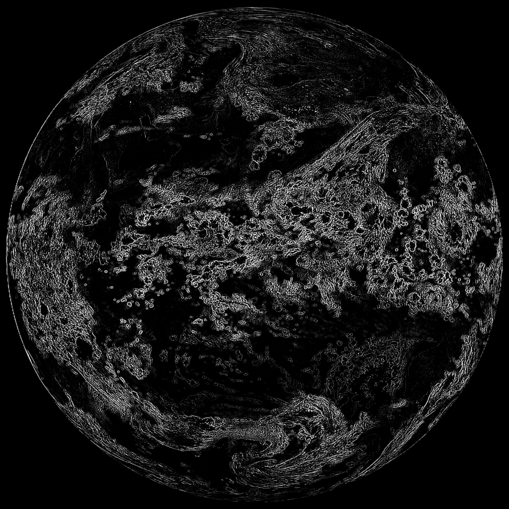
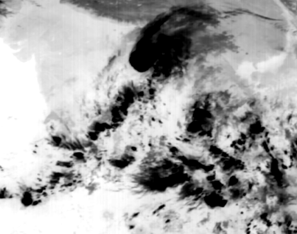
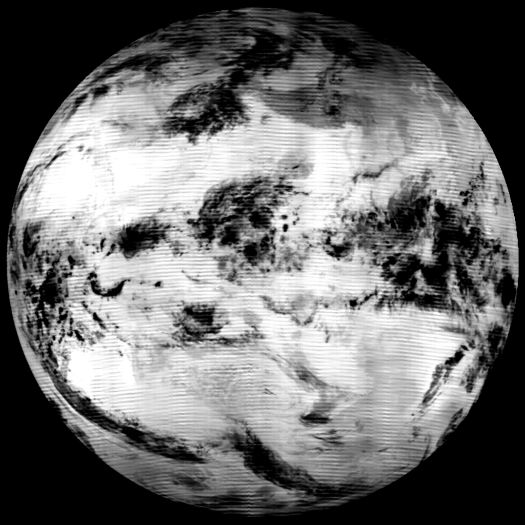
Starting out, here’s what I would describe as a ‘known good’ L3 IR10 LRIT image from mid January 2023. Notice the sharpness of the cropped image? Yea, that’s what is expected from this sat.
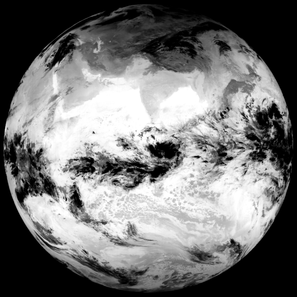
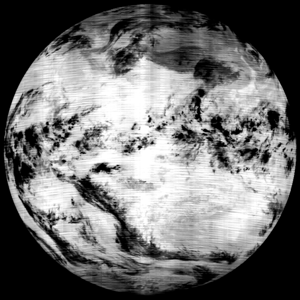
Two weeks ago (16 Nov) IR 10 images were transmitted with ~ 25% less file size. The above example image was 4.3MB. This image (20231116T2130Z) was 3.3MB. Notice the blurring in the crop, as well as the vertical lines in the FD image.
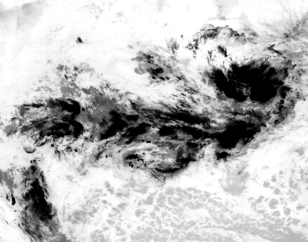
From here things only got worse. The lack of clarity and vertical banding was joined by this weird horizontal banding and was first observed at 20231117T1830Z.
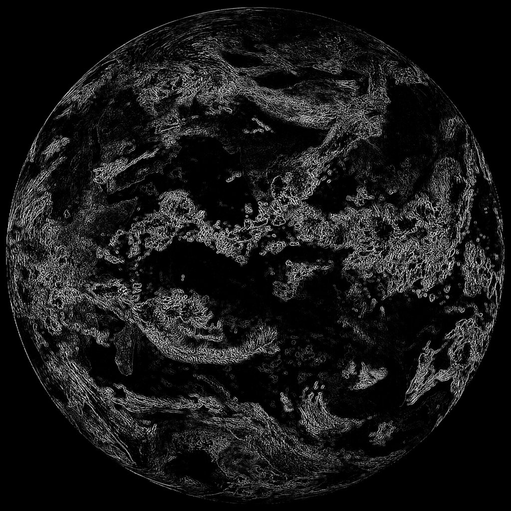
From there, things went from not good to very bad, as seen by the below image. the first transmission like this occurred at 20231121T0030Z.
At this point I was pretty sure an outage of both LRIT and HRIT would occur, as I’d seen these issues in the past, That is the process I assumed occurred historically as the transmission schedule would skip a timeslot only to return with the issue resolved.
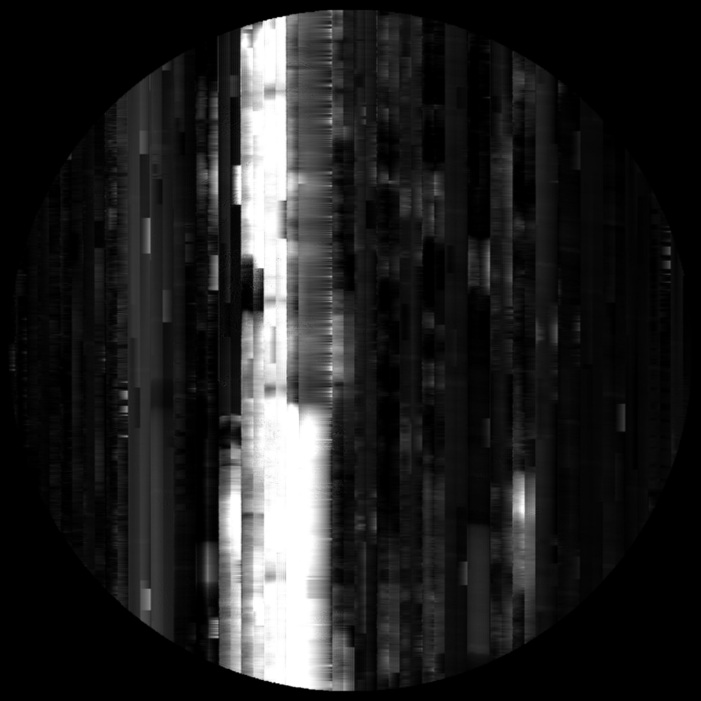
BUT, this time was different. the 20231121T1530Z timeslot gave me the below image. In my entire time running an L3 LRIT station I’ve never seen an image like this.
After that transmission, I assume a reboot occurred. There was no LRIT or HRIT tramsmisison at the following 1830Z timeslot. But service returned afterwards; sadly still in a degraded state.
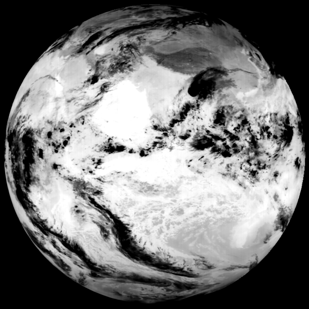
During the 20231122T2130Z transmission the IR 10 images returned to the reduced resolution images like the ones highlighted in at the start of this thread. Horizontal banding returned in force during the 20231124T1230Z transmission.
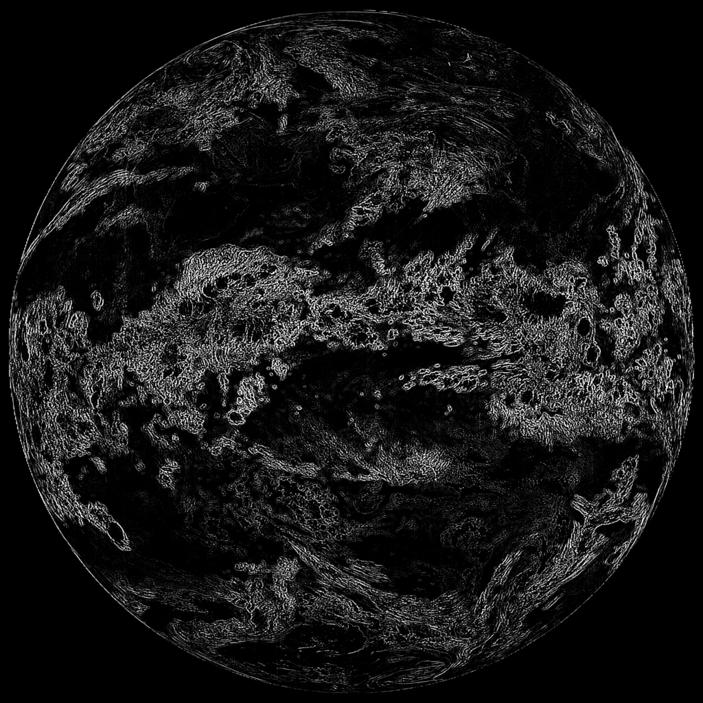
Finally the inverted mess of an image returned at the 20231127T2130Z transmission, and has been like this ever since. Below is the latest image transmitted at 20231130T0330Z, where the issue is still present.
As mentioned, issues with the Elektro-L3 LRIT IR 10 imager have been seen before. The main difference with the current situation is the duration of this degredation combined with the lack of resolution post reboot.
I wasn’t around with L2’s LRIT service died, but speaking to people in the wider community apparently this behavior is similar to what L2 did before it’s LRIT service died.
Fingers crossed L3 LRIT doesn’t end up the same way.